
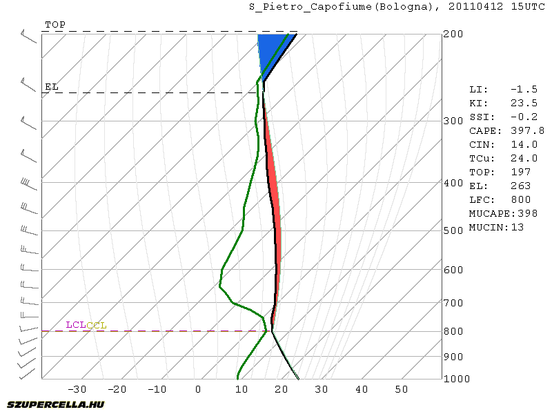
Another front will pass central Europe on Tuesday afternoon/evening. The bad news is the front will come rather late in the evening across the Alps. There should be enough CAPE for moderate convection. Best CAPE is forecast around Bologna-Venice region where GFS is drawing around 600 J/kg, but marginal CAPE will be present all the way from W-Italy to E-Hungary. Decent deep-layer shear will be present (>15 m/s), but with the lack of any low-level jet, storms will tend to merge into lines on the front. The best conditions for rotating storms are south of Venice where some veering winds and consequently moderate SREH3 are present. With some organization, large hail is possible. Pre-frontal afternoon initiation is questionable given the lack of serious convergence, but there will be only little CIN (up to 50 J/kg) so diurnal heating could speed things up.
Another interesting area will be in NE-Slovenia and W-Hungary. Strong backing winds will be present but with little CAPE. Storms on the front will quickly get elevated and any severe threat will be diminished rather soon.
After the front will pass, the air will stabilize and we do not expect any severe weather threats soon.

No comments:
Post a Comment